Can you fly drones for filming in Western Maryland?
Western Maryland offers stunning mountain vistas and historic industrial backdrops for aerial cinematography, provided you navigate the mix of FAA regulations and state park restrictions.
Drone Regulations in Allegany and Garrett Counties
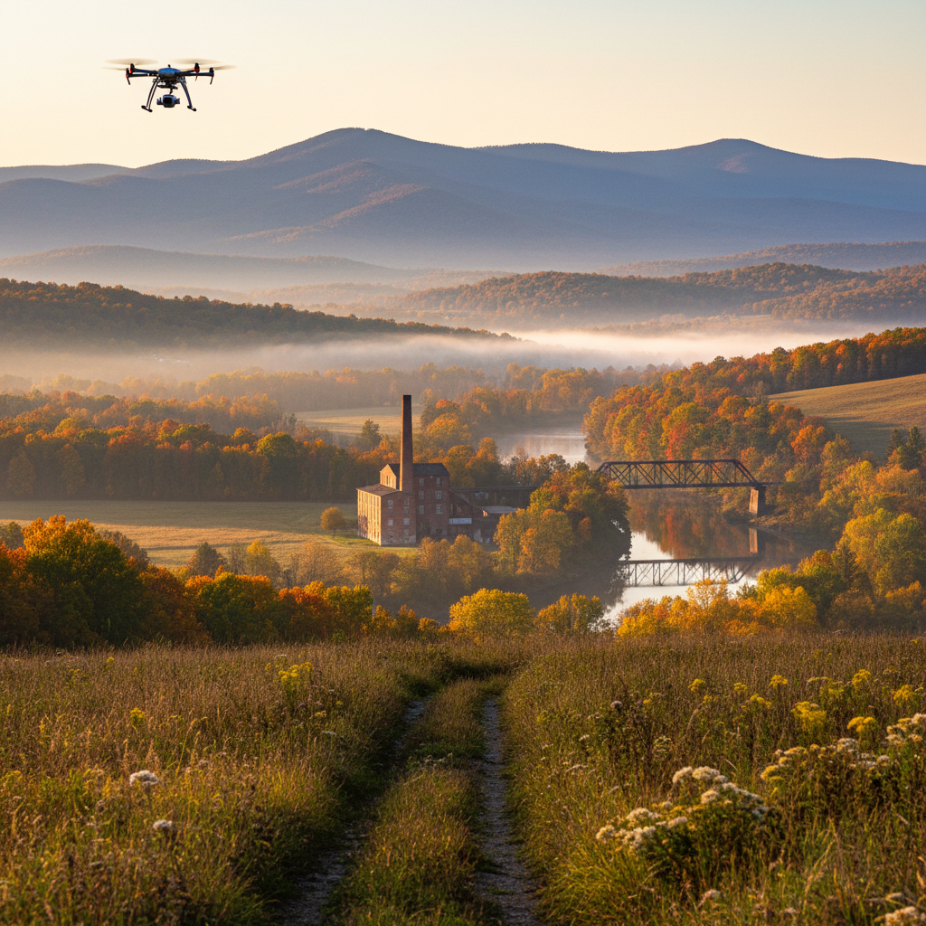
Yes, you can fly drones for filming in Western Maryland, but the ease of your flight depends entirely on your specific location relative to municipal centers and state-protected lands. Most of the airspace over Cumberland and the surrounding Allegany County is Class G (uncontrolled), making it a prime location for aerial cinematography. However, because we are situated in a mountainous corridor, you must account for abrupt elevation changes between the valley floor in downtown Cumberland and the ridgeline of Wills Mountain or Big Savage Mountain.
Federal Aviation Administration (FAA) Part 107 regulations are the baseline here. For commercial productions, your Remote Pilot in Command (PIC) must be certified. While the airspace is generally open, you must remain vigilant regarding the proximity of the Greater Cumberland Regional Airport (CBE) across the river and the local hospital helipads. Most of the region does not fall under the restrictive DC Special Flight Rules Area (SFRA), but checking B4UFLY or LAANC is mandatory before launching near the city center or LaVale.
Navigating State Parks and Public Lands
Western Maryland is defined by its state-owned acreage, including New Germany, Rocky Gap, and Deep Creek Lake State Park. Flying a drone in Maryland State Parks requires more than just an FAA license; it typically requires a Special Use Permit. If you are planning to capture the dramatic foliage over the Allegheny Front or the rocky outcrops of the North Branch of the Potomac, you should consult our filming guide to understand the lead times for Maryland Department of Natural Resources (DNR) approvals.
For locations like the C&O Canal National Historical Park, which terminates in Cumberland, National Park Service (NPS) regulations apply. Launching, landing, or operating a drone from within National Park boundaries is prohibited without a specific, and often difficult to obtain, permit for commercial filming. Savvy local pilots often circumvent this by launching from private property or municipal land adjacent to the canal, provided they maintain line-of-sight and do not harass wildlife or visitors.
Topography and Technical Challenges
Flying in the Appalachians presents technical hurdles that flatland pilots might not anticipate. In places like Lonaconing or the narrow gaps of the narrows near Cresaptown, signal degradation is a real concern. The steep valley walls can cause GPS multipath errors or intermittent loss of transmission between the controller and the craft.
Weather is the other major factor. While Cumberland sits in a bit of a rain shadow, the ridges of Garrett County near Oakland and McHenry experience significantly higher wind speeds and rapid cloud-base changes. A clear day in the valley can be a complete white-out on Top of Allegheny. If you need local scouts who understand these microclimates and can recommend the best launch points for "golden hour" shots over the Great Allegheny Passage, check our production directory.
Local Logistics and Coordination
Logistically, Western Maryland is an ideal "fly-in" location for drone crews based in larger hubs. We are a reliable 2-hour drive from both Washington D.C. and Baltimore, and about 2.5 hours from Pittsburgh. This allows for a "day-trip" footprint for specialized aerial teams.
For larger productions requiring multi-day aerial surveys or complex heavy-lift drone operations, the infrastructure in Cumberland provides a solid base. You have access to high-speed internet for dailies uploads in the historic downtown, ample lodging for crews, and large staging areas. Unlike the dense suburban sprawl of the I-95 corridor, the "low-pressure" environment here means fewer bystanders and less bureaucratic friction when blocking off small sections of municipal streets for safety. If you are ready to scout specific ridgelines or need help connecting with local landowners for private launch sites, you can submit a request through our office to get started.
Frequently asked questions
What are the height restrictions near the Cumberland Narrows?
Standard Class G airspace (uncontrolled) goes up to 400 feet AGL. Given the extreme terrain shifts near Wills Mountain, pilots must be careful to measure altitude relative to the ground immediately below the drone, not the launch point in the valley.
Does Cumberland support LAANC for instant drone authorization?
Yes, the Greater Cumberland Regional Airport (CBE) supports LAANC (Low Altitude Authorization and Notification Capability), allowing for near-instant automated airspace authorization in most of the surrounding areas.
Can I fly over the C&O Canal terminus in Cumberland?
The C&O Canal is governed by the National Park Service, which currently has a service-wide ban on the use of drones. You cannot launch or land within the park boundaries without a rare, project-specific permit from the NPS.
Are there local municipal ordinances against drones in downtown Frostburg or Cumberland?
While the town is welcoming to film crews, flying over people and moving vehicles requires specific FAA waivers (Category 1-4) or a drone with the appropriate safety equipment (like parachutes) as per the updated Part 107 rules. Coordination with local police is recommended for any low-altitude street filming.
Do I need a permit to fly at Rocky Gap State Park?
State Parks like Rocky Gap require a Special Use Permit. Applications should typically be submitted at least 7-14 days in advance and require proof of insurance and an FAA Part 107 certificate.
See more in the directory or submit a production request.